Category: YAR & Features

Young Arctic Researchers & Features

  • Arctic Christmas, Christianity and beliefs

    Arctic Christmas, Christianity and beliefs

    The Coke Santa-clausNow in the Arctic region, as elsewhere, the time of Christmas has started, except for in the Russian Arctic. In various regions in the Arctic, Christmas is a quite new idea which was introduced by western missionaries. The North has been a periphery for western civilization for numerous years and western Christmas traditions do not root so deep within Arctic communities.

    Everywhere along the Arctic, Christianity was brought upon, pronounced or forced to the residents in the Arctic region. As a result, vast majority of all Arctic residents are affiliated with some form of Christianity. Various Protestant churches dominate in northern Fennoscandia, Iceland, the Faroe Islands, Greenland, Alaska, and parts of northern Canada, while the Russian Orthodox Church is prevalent in the Arctic regions of the Russian Federation and in addition has limited presence in Alaska and parts of Finland.

    Finally, the Roman Catholic Church is particularly strong in parts of Canada and Alaska. There is considerable variation as to when Christianity reached different parts of the Arctic. While it happened almost 1,000 years ago in northernmost Europe, the inhabitants of the Chukchi Peninsula in the Russian Far East had little first-hand experience with Christianity before the 1990s. Generally speaking, the 18th and 19th centuries were the major periods of religious conversion in the Arctic. There have been various attempts to explain the rapid conversion of Arctic peoples to Christianity. Most authors agree that a combination of several factors is responsible. The adoption of Christianity rarely, if ever, resulted in the simple replacement of one religious system by another. Instead, old and new beliefs were reintegrated within a new system that was both Christian and local (Arctic Human Development Report).

    Even though Christianity was brought to the Arctic region, old pagan beliefs persist among Arctic residents. All northern indigenous peoples believe that there is a close relationship between humans and nature. Humans and animals are said to be able to understand each other. Animals were said to have spirits which affect the fortune of humans.

    Angry spirits caused illness and benign spirits helped the hunter by guiding animals into his path. Traditionally, the wishes of the spirits could be found out by a spirit medium called a shaman. In a special ritual performance, the shaman would go into a trance. It was thought that the shaman’s soul had left his or her body and flown to the land of the spirits. Here, the shaman would try to get back the soul of a sick person which had been captured by the spirits, or to get the spirits to promise that the hungry community would catch an animal (The Arctic Is). These believes are called shamanism and animism.

    However, Some of these beliefs have grown weaker during this century under the influence of Christian missionaries, teachers and government officials. For a long time, indigenous peoples themselves turned their backs of these beliefs in order to appear ‘modern’. But many ideas about the relationship between humans and animals remain strong. Some Inuit in Greenland still whisper ‘thank you’ to a seal they have just killed (The Arctic Is).

    Winter Solstice

    The complexity of modern Christmas celebrations should be seen in a historical perspective. In the early Christian Church, Easter, not Christmas, was the most important religious feast. Christmas celebrations only gained importance in the 4th century AD. The Roman Church adopted the date of December 25, celebrated by the Romans as the winter solstice. The choice expresses the close connection between Christ and the sun in early Christian religion. Christ rapidly adopted striking features of the sun god Helios such as the halo. In the Roman Empire the celebration of Christmas replaced the feast of Sol Invictus, the rebirth of the sun at December 25.

    The seasonal significance of the winter solstice is in the reversal of the gradually lengthening nights and shortening days. How cultures interpret this is varied, since it is sometimes said to astronomically mark either the beginning or middle of a hemisphere’s winter. Winter is a subjective term, so there is no scientifically established beginning or middle of winter but the winter solstice itself is clearly calculated to within a second. Though the winter solstice lasts an instant, the term is also colloquially used to refer to the full 24-hour period of the day on which it occurs. Worldwide, interpretation of the event has varied from culture to culture, but most cultures have held recognition of rebirth, involving holidays, festivals, gatherings, rituals or other celebrations around that time (Wikipedia).

    However, by a description of Franz Boas, the celebration of winter in an Inuit community in Qiqirtat (Kekerten Island, Canada), feast was not connected to the winter solstice, but prepared the hunting of the winter season. In the course of the ritual the success of the hunt is assessed in various divinatory games such as the tug-of-war of the ptarmigans and the ducks. Thus we may infer from the structure of the ritual that the relationship to the spirits of the dead is decisive in determining the success of the hunt. It is remarkable that the animals themselves never are partners in the ritual interactions between the Inuit with either the spirits of the dead or Sedna and her representatives, the qailertetang (Le Journal de la Société des Américanistes)

    Beiwe
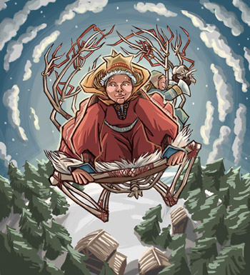
The Saami, indigenous people of Finland, Sweden and Norway, worship Beiwe, the sun-goddess of fertility and sanity. She travels through the sky in a structure made of reindeer bones with her daughter, Beiwe-Neia, to herald back the greenery on which the reindeer feed. On the winter solstice, her worshipers sacrifice white female animals, and with the meat, thread and sticks, bed into rings with ribbons. They also cover their doorposts with butter so Beiwe can eat it and begin her journey once again (Wikipedia).

    In Scandinavia and Iceland the arrival of Juletid (Christmas) came to refer to the midwinter celebrations. By the late Viking Age, the Yule celebrations came to specify a great solstitial Midwinter festival that amalgamated the traditions of various midwinter celebrations across Europe, like Mitwinternacht, Modrasnach, Midvinterblot, and the Teutonic solstice celebration, Feast of the Dead. A documented example of this is in 960, when King Håkon of Norway signed into law that Jul was to be celebrated on the night leading into December 25, to align it with the Christian celebrations. For some Norse sects, Yule logs were lit to honor Thor, the god of thunder. Feasting would continue until the log burned out, three or as many as twelve days. The indigenous lore of the Icelandic Jól continued beyond the Middle Ages, but was condemned when the Reformation arrived.

    The celebration continues today throughout Northern Europe and elsewhere in name and traditions, for Christians as representative of the nativity of Jesus on the night of December 24th, and for others as a cultural winter celebration on the 24th or for some, the date of the solstice (Wikipedia).

    Modern Christmas Celebration

    Even though the traditional Christian belief of Christmas is predominant, many local customs and traditions live along the culture among the Arctic and they root to their old pagan roots. In Scandinavia the equaliant for Santa Claus is the Tomte or Nisse. It is a mythical creature of Scandinavian folklore originating from Norse paganism. Tomte or Nisse were believed to take care of a farmer’s home and children and protect them from misfortune, in particular at night, when the housefolk were asleep. Tomte is a common Swedish name, derived from his place of residence and area of influence: the house lot or tomt. The Finnish name is tonttu. Nisse is the common name in Norwegian and Danish.

    HurdaskellirThe Yule Lads, Yulemen, or Jólasveinarnir are figures from Icelandic folklore who in modern times have become the Icelandic vector of Santa Claus and are in total of 13. The Yule Lads were originally portrayed as being mischievous, or even criminal, pranksters that would steal from, or in other way harass the population (at the time mostly rural farmers).

    They all had descriptive names that conveyed their mode of operation. The Yule Lads are traditionally said to be the sons of the mountain-dwelling trolls Grýla and Leppalúði. Additionally, the Yule Lads are often depicted with the Yuletide Cat, a beast that, according to folklore, eats children that don’t receive new clothes in time for Christmas.

    In the culture of the eastern Slavs the traditional character Ded Moroz plays a role similar to that of Santa Claus. The literal translation of the name would be Grandfather Frost. Ded Moroz brings presents to children. However, unlike the secretive ways of Santa Claus, he often brings them in person, at the celebrations of the New Year, at New Year parties for kids by the New Year Tree.

    The “in-person” gifts only occur at big organized celebrations, where the gifts can be “standardized.” The clandestine operations of placing the gifts under the New Year tree still occur while the children are young. Ded Moroz is accompanied by Snegurochka or ‘Snow Maiden’ , his granddaughter. The traditional appearance of Ded Moroz has a close resemblance to that of Santa Claus, with his coat, boots and long white beard. Specifically, Ded Moroz wears a heel-long fur coat, a semi-round fur hat, and white valenki or high boots (sapogi), silver or red with silver ornament. Unlike Santa Claus, he walks with a long magical staff, and drives no reindeer but a troika (Wikipedia).

    Santa on the Northpole
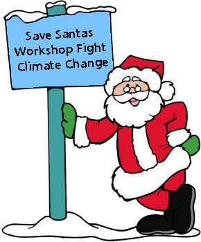
Nowadays, The traditional western Santa Claus is considered to be an Arctic resident. While his exact location is not known, there are some strong beliefs that his whereabouts are at the North Pole where he has his toy factory. However scientists have not yet discovered the Santa Clause home even though that various observations have been taken place in the Arctic, close to the North Pole and on the Pole itself. Dispite that fact, Santa Claus still appears every year and brings joy to thousands of peoples all across the world.

    Due to that fact alone, people should be aware of the changing climate and global warming, for the Santa´s workshop might be at risk.

    The Arctic Portal staff wishes all it´s readers and users Merry Christmas and a Happy New Year!

    Arctic Portal.org needs your support to continue its successful journey! – Help us make Arctic Portal.org even better!

  • Arctic Frontiers 2013 – Final Remarks

    Arctic Frontiers 2013 – Final Remarks

    Arctic Frontiers

    The increase in human activity in the Arctic region, which is driven by the ever increasing demand for decreasing stocks of natural resources (mineral as well as hydrocarbons), has led to a rise in the need for improved management, monitoring and surveillance of the region.

    The weather conditions may change quickly and dangerously, while the presence of the sea ice poses a risk to ships. For those reasons, the need for frequently updated information has increased.

    Arctic Frontiers has been yearly organized as an independent network and leading meeting place for pan Arctic issues. This year’s Arctic Frontiers took place 20th – 25th January in Tromso, located in the northern part of Norway.

    This year’s event collected close to 150 speakers from variety of countries. The audience accounted close to 2 000 people from various Arctic states and different fields of expertise. Both groups were largely supported by 35 journalists from 15 different countries. This number does not include the many local Norwegian media.

    Leona Aglukkaq, Minister of Health and the Canadian Northern Economic Development presents during the policy sessionFirst two days were occupied by the policy section titled: Geopolitics and Marine Production in a changing Arctic”. This year’s policy session gathered speakers from the eight Arctic countries bringing up issues from charring and managing the Arctic Council, fisheries, oil and gas exploitation and the right and responsibility of the Arctic peoples to manage their territories to the role of armed forces in the Arctic.

    Non-Arctic states were also well represented. The policy session welcomed speeches from the Ambassadors of China and South-Korea as well as from the EU Commissioner for Marine Affairs and Fisheries , while the science section’s geopolitics session expanded the Asian representation to cover diverse range of issues regarding Japans, South-Koreas, Singapore and India’s interests in the Arctic.

    Non – Arctic states, together with the representatives of the Arctic, came up with new principles of how to manage, explore and develop the Arctic in the light of an on – coming change.

    Today the Arctic Region is an emerging energy and mineral province, with the extraction of natural resources projected to increase dramatically in the coming years to decades. New industrial activities, a changing business community and demographic dynamics are to alter the established social and economic structures in several regions of the Arctic.

    In short it can be said, that the non-Arctic countries call for an open and inclusive trans-regional dialogue and resource management and inclusive observer policies for the Arctic Council. In their view, the Arctic is not isolated region within the global economic and resource community, but a part of a global system that should be governed by and benefit all countries in the world.

    It occurred evident that the interest towards the Arctic is growing and southern countries have started to grow increasing interest on the emerging opportunities in the Arctic.

    In addition to the two day policy section, the Frontiers had a comprehensive science section concentrating this year on the above mentioned geopolitics, marine harvest and marine production.

    Speakers during the science sessionThe science section addressed mainly the issues of security, energy and interstate relations in the Arctic. Overall, it identified conditions of continued stability in light of new developments in the northern hemisphere.

    A warming Arctic Region with less ice may involve opportunities in terms of economic activity and increased interstate cooperation, but may also present the Arctic stakeholders with new challenges in terms of how best to meet their interests and at the same time interact with the other stakeholders through mutually beneficiary relations.

    The Arctic potential to become a new, thriving energy region was strongly highlighted during first days of the policy session.

    The circumpolar North holds large quantities of natural gas and oil, both discovered resources and estimated ones. Northern Russia has the largest known reserves of natural gas in the Arctic, but it can also be found in other regions such as Norway, Canada and Alaska.

    Last day of the science session welcomed representatives of non – Arctic states, such as Asian and European states that do not border the region. Those countries and organizations have been increasingly opening their eyes into the changing North. The speakers tried to answer the questions of does their interest consist of and what is their policy towards the Arctic Region.

    The Arctic region has many faces. Historically it has been veiled by an aura of mystique, a frozen wonderland untouched both by the outside and the effects of industrialization, populated by a mysterious group of people from a different phase in the history of man. As interesting and romantic this notion may seem, it holds little or no truth in the Arctic today.

    Happy participants during the coffee breakThe Arctic is literally on top of the world, the earth rotating around the two poles, in the North and the South. But the Arctic is not just about the North Pole – the Arctic region stretches much further in all directions, even splitting the earth into the East and the West, famous identities in the world history.

    This year’s Arctic Frontiers highlighted that the Arctic is not only a historical and cultural region but also a potential for commercial and industrial activities. The meeting showed that the Arctic should be looked at as at the mixture of traditional subsistence activities as well as a part of the global market economy.

    Leena & HMM

  • Chasing Ice premiers

    Chasing Ice premiers

    Melting ice in GreenlandChasing Ice, a film by Jeff Orlowski, was premiered on December 14th. The movie follows photographer James Balog through his journey in the Arctic and his Extreme Ice Survey.

    Once a skeptic about Climate Change, Balog went on a mission to record climate change first hand. By deploying revolutionary time-lapse cameras to capture a multi-year record of the world’s changing glaciers, he managed to put together amazing videos of climates effect in the Arctic.

    Orlowski followed Balog around the world and the result is the film, which has been shown on film festivals since this fall.

    The films website states: “Traveling with a team of young adventurers across the brutal Arctic, Balog risks his career and his well-being in pursuit of the biggest story facing humanity. As the debate polarizes America, and the intensity of natural disasters ramps up globally, Chasing Ice depicts a heroic photojournalist on a mission to deliver fragile hope to our carbon-powered planet.”

    Filming took place in various locations, not only in the Arctic. They include Greenland, Iceland, Alaska, Glacier National Park in Montana, the Alps, Bolivia and Canada.

    Speaking in a Q&A, director Orlowski described the biggest challenges of the shooting. “The biggest challenge was the harsh environments. We had weather as low as negative 30 degrees. One winter night in Greenland, I thought I was going to freeze to death in our cabin. Our heater was leaking gas so we decided to go to sleep without it. I woke up in the middle of the night from my own teeth chattering. I rubbed my body to stay warm, and suffered until sunrise. But as cold as it was, and as difficult as it may seem, that was all the fun stuff. I’d do it all again in a heartbeat. I’d much rather be out shooting than editing!”

    Sources

    Chasing Ice

    See also:

  • From everywhere but Antarctica!

    From everywhere but Antarctica!

    Field trip to Dynjandi

    A master’s program in Coastal and Marine management on the Western tip of Iceland sees students from all over the world engaging in Arctic studying. The University Center of the Westfjords hosts the program which is described as a cross-disciplinary program that prepares students for diverse positions in both the public and private sectors.

    Among courses thought are Iceland’s Environment and Natural Resources, Understanding the Coast and the Ocean, Underwater Heritage, Aquaculture and Marine Renewable Energy.

    The University of Akureyri cooperates with the studies, UNAK has specialized in fisheries science and related matters for many years.

    The program at the University Centre of the Westfjords has been running since 2008. Before the program started it sought recognition and quality control from the University of Akureyri which in the end is responsible for the diploma. The fifth years started this fall but in total 40 students have graduated, the first ones in 2010.

    The website also states: “Among the fields which the master’s program in Coastal and Marine Management prepares students to work in are resource and land use planning, environmental impact assessment, consulting work, teaching and research. The program is internationally oriented and taught in English, and both students and instructors come from a diverse range of countries.

    The master’s program in Coastal and Marine Management brings together people of different backgrounds who share their experience, knowledge, and ideas in a small-scale, creative and fertile intellectual environment, with the goal of finding ways of using natural resources in a sustainable way. We welcome new faces to join our exciting group of natural resource management specialists.”

    A total of 92 have started the studies, 40 graduated and 46 are currently studying. Only a few have have abandoned the studies. “The students love their graduation day; they have a whole fjord for themselves!” Dagný Arnarsdóttir, the Program director, told BB, a local newspaper. The graduation is held in Hrafnseyri in Arnarfjordur, famous for the waterfall Dynjandi.

    Field trip in the westfjordsAccording to program manager Ingi Björn Guðnason the program has used social media for advertisement to reach the right people. “We have used Google and Facebook ads to lead people to our website which has detailed information about the program. We have also used specialized websites for advertisement which show different programs for students who want to travel to study. Later we have been lucky that the word has simply spread out about the program which we can thank both the students who have a good experience from here and the teachers as well. They have helped advertising the studies in numerous ways. That is probably the most effective advertisement, positive feedback from the students who talk to their friends about it. This positive feedback has allowed us to cut back on advertisement costs which were running high in the beginning.”

    Ingi says that visits to the University Centers website have increased greatly after this program was founded. They have grown greatly and can reach 700 per day, but in total it has 95.000 visits for the last year.

    Structure

    The program has three semesters, fall, spring and summer, which runs from April to July. Next is a thesis but students need to post a detailed description of their intended study for acceptance of a concession committee. “This year we will have a specialized workshop for the thesis and the result is a thesis question. Most students are graduated within two years but if they want they can leave after the courses, which take 18 months,” Dagný says.
     

    Each course is thought in a session, ranging from 2 to 8 weeks. They include lectures and individual and group projects. “We also try to use new technology as much as we can. Tests in a class room can be necessary in some countries, but how knowledge is measured and assessed, can differ greatly. We try to offer real project in the field when we can. We also use role-play for example to discuss different aspects to subjects from different groups. I see different kinds of valuations for the Universities in the future. A new generation is coming up of both teachers and students are coming up and the schools will have to adjust.”

    Westfjords the focal point

    The location of the program is unique, in the West of Iceland, which has some of the most prosperous fisheries in the country, and breathtaking landscape. “We encourage students to do their projects about the area here and the result is that two out of three have written or done material about the Westfjords or its fisheries. Students have a reputation of wanting to give something back to the society here and by filling in gaps of knowledge about anything related to the studies, they do so, for example writing about sustainable coastal areas or exploitation and protection of the oceans and the coast. The students often have close cooperation with organizations and companies for their thesis work.”

    Puffin in Iceland

    Many nationalities

    “We get applications from all over the world but we have to limit the students to their capabilities with first grade or higher, their language skills (for example the TOEFL test) and if we can be assured that their material is authentic. Over the years most students have come from Canada but it’s getting more international and more Europeans have come in over the last two years. We have representatives from every continent now except for Antarctica!”
     

    “The students choose their projects in a number of manners, Icelanders tend to write a little bit more about Icelandic related projects, but international students do the same, they also write about Icelandic projects.”

    Diversity in teachers

    Since the program has very little structure, no permanent staff for example, the knowledge has to be sought from diverse backgrounds. Getting teachers and instructors over the years has run smoothly and they are both Icelandic and international. “This is a real sign of quality for us. We have very high standards and have specific goals to keep, and this shows quickly in the Icelandic university environment.”

    “After the studies the students have either continued to study, either doing PhD studies and other masters programs. Most often the students go to their homes for jobs related to the studies. Many of them have excellent jobs, a few work in project management, some are specialists in ministries, some in aqua centers or national parks. One runs the biggest national park in Canada, one has built a national Park in East Congo under very hard circumstances. And our students have kept in touch with the Westfjords and will be back with their families at some point! They help us in promoting the area, and Iceland.”

    Future prospect

    “The future will see the University Center promote the knowledge even better than before, for example by translation projects to Icelandic. Another aim is to maintaining the knowledge in the studies with the institutions in Iceland,” Dagný says.

    Sources

    Bæjarins Besta

    University Center of the Westfjords website


    See also:

    Click here to enter the
    Arctic Portal News Portlet

  • Transpolar flights, a shortcut through the Arctic

    Transpolar flights, a shortcut through the Arctic

    Arctic Voyage of Richard Byrd and Umberto Nobile

    “Aviation is a proof that given, the will, we have the capacity to achieve the impossible.”

    Eddie Rickenbacker

    Long before the jet age, commercial aircraft were flying through the Arctic Circle. After the successful voyages of Richard Byrd and Umberto Nobile in 1926, the feasibility of polar aviation was demonstrated in actual practice. Nowadays, commercial traffic, connecting Europe, North America and Asia through the north polar routes is a routine.

    Cross-polar air corridors bring new opportunities for both commercial and private travel markets. Transpolar aviation reduces the burn of fuel by making the travel time shorter what lowers the cost of trans-polar air operations.

    Flying direct paths between many of North American and Asian cities also decreases the environmental threats of greenhouse gases emissions, which are now one of the major concerns of the Arctic States.

    Polar air corridors refer to aircraft routes lying across the uninhabited polar ice cap region, 78 degrees north from the northern latitude what includes areas of northern part of Alaska and most of Siberia. Term of Polar Route was originally adopted in the middle of 20th century and applied to the great circle between Europe and west coast of North America.

    The Polar Route formally opened after the Cold War for commercial flights between Europe and Asian Far East as before that period civilian flights were not able to cross the air space over the Soviet Union and China as those countries were much concerned about the possibility of trans-polar attack.

    Nowadays commercial traffic through the northern hemisphere is operated by various aircraft as Boeing 747 – 400 and Airbus A340, with ranges of around 7000 nautical miles. In 2001, Arctic States adopted policy letter, Guidance for Polar Operations, which outlined a number of specific requirements for polar flight operations, including cold weather conditions, special communication capabilities, fuel freeze strategy, evacuation and recovery plans for abandoned passengers and special monitoring requirements as the aircraft operating in the Arctic rely almost exclusively on satellite communications, where a pilot´s signal is beamed into the space and bounced back to a ground control station.

    Modern aircraft flying the polar route

    Arctic operating planes handle the distances between Europe, Asia and North America and are managed by various airlines. The International Air Transportation Association proposed the establishment of the Pacific Project which would meet the increasing air traffic demand between Asia and North America which is very likely to double by the end of 2025.

    Opening of new and improving strategies on already used air traffic routes offer possibilities to reach various locations in the northern hemisphere in easy and cost efficient way.

    Trans-Arctic shipping routes appear to emerge as the fastest way of transportation between North America and Asia. Flying direct paths across the uninhabited Arctic ice cap region, helps aircraft to reduce the fuel burns, travel time and associated environmental carbon emissions.

    Advanced transportation technology increases the importance of airships for trade and economic development. It is being defined that aircraft able to fly the Polar Routes are the most competitive in northern areas without highly developed infrastructure.

    There are 676 airports currently maintained around the Arctic and majority of them is situated in Alaska, United States. There are 79 airports in Arctic Canada, 71 in Russia, 62 in Denmark (Greenland and Faroe Islands), 56 in Norwegian Arctic including Svalbard, 55 in Finland, 35 in Sweden and close to 20 in Iceland. Not all of them exist as ports of entries for international traffic as those are partly used domestically.

    (Map: Arctic Portal) Air shipping routes Interactive map aims to locate and provide with significant information with regards to Arctic airports. This research will show the mechanisms associated with Arctic air traffic in rather difficult, unique climate and familiarize with Arctic airports locations and information with regards to runway length and elevation to indicate approximate size of the airport and load classification.

    Trans – Arctic aviation leaves a significant scare in the fragile Arctic environment. All forms of air traffic used to cross the Arctic air space emit carbon dioxide and other greenhouse gases, like oxides of nitrogen and water vapor, into the northern atmosphere.

    Emissions of an Arctic airship can vary significantly, according to the size of the aircraft, the number of passengers on board, the distance of journey and the altitude as it was proved that aircraft flying on high altitudes produce more carbon dioxide than those operating on lower altitudes.

    Reducing air travels and Arctic air tourism opportunities seem to be another alternative way to reduce aviation impact on climate change and Arctic environment. If future travel demand could be managed with supplementary ways of transportation, increased taxation would not be needed to be implemented by the Arctic States.

    To read more about Arctic aviation, please enter the Aviation chapter in Arctic Portal Shipping Portlet.

  • Arctic oil: setting risks too high?

    Arctic oil: setting risks too high?

    “A liquid substance that is greasy to the touch and formed by the breakdown of fats in fossil organic material: Oil.”

    (Map: Arctic Portal) Potential oil and gas fields in the Arctic

    This broad definition for oil is valid from everything between crude oil, the black flammable liquid sought by drilling, to the yellow vegetable oil used in cooking.

    Hydrocarbons – as they are often called – are in the broadest sense organic compounds of hydrogen and carbon. These exist in Earth’s subsurface in either liquid form – which is called (crude) oil or petroleum, or they exist in gaseous form, and then called natural gas.

    This week’s feature will answer the question of what is actual definition of Arctic oil and where it can be found. It will try to make you familiar with the long history of the Arctic oil as well as its formation and extraction. It will conclude with few words on environmental protection and prospects of future development.

    Oil rig at sea

    The “tool” to find deposits of oil or gas is the scientific branch of petroleum geology. Petroleum has a reputation as “Mother of all Commodities” as a number of materials are produced on a petroleum base – such as petrol, kerosene, plastics, medicines, basically all forms of organic chemicals. It is the most traded good amongst humans on this planet, followed by coffee and then natural gas. It is also the leading energy source of mankind: The combustion of fossil fuels—coal, oil, and natural gas—provides by far the largest portion of the current supply of energy.

    Within the Arctic, oil is today mainly found in three regions: The Beaufort Sea coast (North Slope of Alaska and the Mackenzie Delta of Canada), the Canadian north-eastern Arctic (Nunavut), and northwest Russia.

    In 2008, the US Geological Survey published an estimate of the undiscovered deposits in the Arctic. The impressive result was, that the area north of the Arctic Circle is expected to hold an estimated 90 billion barrels of undiscovered, technically recoverable oil, 1,670 trillion cubic feet of technically recoverable natural gas, and 44 billion barrels of technically recoverable natural gas liquids in 25 geologically defined areas thought to have potential for petroleum.

    These resources account for about 22 percent of the undiscovered, technically recoverable resources in the world. The Arctic accounts for about 13 percent of the undiscovered oil, 30 percent of the undiscovered natural gas, and 20 percent of the undiscovered natural gas liquids in the world. About 84 percent of the estimated resources are expected to occur offshore.

    Current oil and gas production areas

    Since fossil fuels are not renewable source of energy, their price and costs of production increase in line with increased consumption and diminishing known reserves. This leads to pressure to explore oil from territories earlier regarded as inhospitable.

    The Arctic and its resources are thus coming into focus: Depending on oil prices and the supply of oil from existing producing regions, such as the North Sea and the Middle East, there will likely be an increasing pressure to develop the Arctic reserves. There can already be seen strong indications that Arctic becomes one of the main sources of oil and gas in the twenty-first century.

    Historically there are three main regions in the Arctic linked to oil exploitation: the Beaufort Sea coast (North Slope of Alaska and the Mackenzie Delta of Canada), the Canadian north-eastern Arctic (Nunavut), and northwest Russia (Barents Sea and West-Siberia).

    Within the three, first developments of oil and gas fields took place in Russia (Komi Republic), then in Canada (Alberta) and finally in the USA (Alaska).

    Comparison of the development of oil and gas fields in the circumpolar North reveals two fundamental models of developing these resources: the European (or North Sea) model and the American (USA, and partially Canada) model. Both of which occur with regional peculiarities.

    The European model is often described as an “interventionist” or “state capitalist” system. Often a state-run national oil company plays the central role in developing and managing the resource. Private companies also participate directly, often in cooperation with these national oil companies. In addition the state has strong influence on the administration, issuing and allocation of production licenses including a strong influence on the requirements expected from private companies engaging in this model.

    Oil lies several layers down the earth

    In the so-called American model the state mostly has a regulatory role. Control over production and development is left in a relatively exclusive degree to private companies who obtain and compete for licenses and concessions through auctions.

    A major force of development throughout the circumpolar North came during the 1960’s and 1970’s due to political instabilities of major suppliers from the Middle East region. This made development of oil fields in Arctic and subarctic regions economically feasible and politically advisable. The development led to a number of new oil and gas fields both onshore and offshore as well as to the construction of according transport systems (pipelines).

    For example the Trans-Alaska Pipeline in Alaska was built between 1974 and 1977 and in Northwestern Siberia for a total of 14 years, from 1973 to 1986, at least one major construction project was undertaken either for major oil or gas pipelines each year. Often these megaprojects led to controversies with local population, as either resources were on traditional grounds belonging to indigenous peoples or the installation of oil fields or pipelines affected the traditional ways of subsistence (e.g. reindeer husbandry, fishing, hunting).

    There are numerous examples of megaprojects with a varying degree of involvement and participation of local / indigenous people in benefits and profits. Read more in the Megaprojects chapter of the Energy Portlet.

    Oil or hydrocarbon as it is often called – is in the broadest sense organic compounds of hydrogen and carbon. These exist in earth’s subsurface in either liquid form – which is called (crude) oil or petroleum.

    Petroleum and natural gas are formed from ancient biomass, thus the name “fossil” fuels for fuels based on petroleum or natural gas.

    Heating of prehistoric organic material leads to the formation of crude oil and natural gas. This happens over a long time via a set of complex biochemical and geological processes of pressure and seclusion from air (anaerobic conditions). The organic material usually mixed with mud clay, got buried under strong layers of sediment, thus generating conditions of high pressure and heat.

    This caused organic matter first to develop to a substance called kerogen and then with even more heat applied over geological time, becoming liquid or gaseous hydrocarbons.

    The subsurface reservoirs possibly blend with water and accumulate in chambers beneath the surface: The hydrocarbon compounds produced in this way were probably concentrated by being dissolved in water and transported through sedimentary rocks; the deposits were then trapped in dome-shaped chambers. However, petroleum can also remain oil shale or oil sands – such as in the Athabasca region of Canada.

    Oil barrels Prehistoric zooplankton and algae, plants and animals, from sea or lake bottoms, preserved under anoxic conditions, are the basis of today’s crude oil and natural gas. Prehistoric terrestrial plants are mostly the basis for today’s coal.

    Petroleum extraction is the whole process by which hydrocarbons (petroleum) is extracted and removed from the earth. The process is divided in three different stages: location, drilling and the actual oil extraction and recovery.

    Location of oil is defined by seismic surveys and gravimeters or magnetometers. An oil well is created by drilling into the earth with an oil rig. Offshore an oil rig is the platform from which the well is drilled. The actual hole is filled with a pipe made of steel. The idea is to fortify the integrity of the drilled hole. The bottom of the hole is finally perforated to allow oil to pass into the wellbore. On top of the well a structure with multiple valves is placed, called ironically „christmas tree”.

    The actually oil extraction and recovery after locating and drilling is subdivided into three stages.

    Several effects on the environment are linked to the different stages of oil extraction. Terrestrial, avian and marine fauna, flora and humans are all potentially affected when oil is sought. However, the oil spills still seem to be the biggest threat to fragile Arctic environment. Click here, to see the biggest oil spills that occurred close to the Arctic Circle.

    The Arctic is expected to host around 22% of the world’s remaining undiscovered oil and gas reserves, according to a 2008 assessment from the US Geological Survey. According to this assessment this would equal an estimated total oil and natural gas resource of 412 billion barrels of oil equivalent.

    Oil drilling platformAccording to the Energy Information Administration of the USA, the world total consumption of oil barrels per day in the year 2008 was 85.462, the yearly total being thus 31.193.630 billion barrels. This means that the whole world would be around 13 years to use all of the oil in the Arctic, should the whole 412 billion barrels be extracted and produced.

    Around 78% of the Arctic resources are expected to be natural gas and natural gas liquids (NGL). The West Siberian Basin and East Barents Basin are estimated to be key areas, holding 47% of the total undiscovered resources. 94 percent of the resources within these areas are expected to be natural gas and NGL.

    The North American part of the Arctic is expected to hold mostly oil whereas the Eurasian part of the Arctic seems to promise largely extended gas reserves: About 65% of the undiscovered Arctic oil are expected in the American part of the Arctic, compared to only 26% of the undiscovered Arctic natural gas.

    The major share of undiscovered oil deposits is expected to be in Arctic Alaska: About 30 billion barrels. Second is the Amerasia Basin, just north of Canada, with an estimate of about 9.7 billion barrels of undiscovered oil and third the East Greenland Rift, which is estimated to hold about 8.9 billion barrels of undiscovered oil.

    Altogether, these three North American provinces count for an expected sum of about 48.6 billion barrels of undiscovered oil, corresponding to around 54% of the total undiscovered oil in the Arctic.

    In the Barents Sea recent findings indicate that the Skrugard field contains an estimated amount of 250 million barrel oil reserves. Another field, Goliat is currently under development with an estimated reservoir size of 240 million barrels. It is also expected oil reserves are laying around Greenland; however exploration and test drilling have not yet led to any findings.

    Despite expected large reserves, the future of Arctic oil development is depending on technical, political and environmental challenges. Technical challenges are in general the harsh Arctic conditions that put special demands on men and material. Transport systems such as pipelines need to be constructed and in addition face technical challenges as climate change puts new requirements towards materials and construction technologies.

    the Arctic landscapePossible sovereignty disputes over land and sea areas in the circumpolar North could also delay the development of future oil fields. Regional examples such as from the Barents Sea, show how a long-lasting delimitation dispute can hold development for many decades. It was not until the 7th of July 2011, the day the Norwegian-Russian delimitation treaty in the Barents Sea entered into force that the Norwegian side started immediate prospecting for oil and gas.

    Last but not least there is the challenge of the vulnerable Arctic environment and the indigenous people of the circumpolar North that puts high demands to any oil or gas related project in the region. Increased transport, e.g. by tankers will also require new capabilities to Search and Rescue capabilities as well as oil spill prevention. High costs due to high environmental protection demands could delay or even halt a further development of Arctic oil, especially when cost / benefit calculations compare it with other regions.

    An increasing oil price could make the exploitation of oil shale and oil sand reserves e.g. in subarctic regions more reasonable and feasible than an immediate offshore drilling in the Arctic Ocean or adjacent shelves. Still a growing global demand for energy and challenges with energy security e.g. in the Middle-East region can give additional momentum to develop Arctic oil despite the named challenges.

    So despite an anticipated abundance of resources and a high demand, there are still high costs, high risks and lengthy lead-times to be expected that could potentially delay or even stall any further development of oil fields in the Arctic.

    One has thus to be careful in predicting if and when a significant increase in Arctic oil production is to be expected in the future.

    Text: the Arctic Portal

    Source: The Energy Portlet

  • The Arctic and its Peoples

    The Arctic and its Peoples

    Arctic resilience – understanding the integrated impacts of change in the Arctic.

    indigenous numbersThe Arctic region is changing rapidly. Those changes happen in ways that could dramatically affect people’s lives and fragile northern ecosystems. Climate change has been a major concern so far, but rapid economic development and social transformation could also make significant impacts on the Northern Hemisphere.

    Most of the transformations happening in the Arctic require adapting traditional, indigenous knowledge and experience to policy-making processes that happen in the northern region.

    It is crucial for the current political landscape to identify potential ´tipping points ‘that allow to effectively prepare for the uncertain future of the Arctic. It is also crucial to recognize the sources of Aboriginal knowledge and experience.

    What is the traditional knowledge and who are the people that live in the Arctic? How many languages do they speak and how old is really their culture? This week´s feature will try to answer those questions and interest you, dear reader in finding out more about traditional ways of life in the High North, through the Arctic Portlet.

    The Arctic covers 40 million square kilometers or approximately 8% of the Earth’s surface, but hosts a population of only 4 million. Of the 4 million, various small groups of indigenous peoples, peoples who occupied the area long before the people of European tradition came, can be found.

    Almost all of them live today as a minority within the borders of contemporary nation-states. Only in Greenland are the Inuit in majority or 88% of the population while in Canada half of the population in the northern regions is indigenous. In Scandinavia and north Russia, indigenous peoples are only a small fraction of the population or around 4-5%, Alaska having an indigenous population of around 20%.


    (Photo: Getty Images) Reindeer in the wild.Despite that some 40 indigenous languages are still spoken in the Arctic, Russian, English, and Scandinavian languages are the most dominant languages today. Only in Greenland is Inuktitut, an indigenous Inuit language, the only official language of the region. In addition, Canada has just recently approved Nunavut’s proposal to declare Inuktitut, English, and French the official languages of Nunavut.

    There have been inhabitants in the Arctic for at least 12.000 years according to bones found in Russia. Some believe people have lived up North for much longer or up to 30.000 or 40.000 years, but no one knows for sure.

    Little is known about the earliest people from 12.000 years ago, but the culture and livelihoods of the Inuit and the Saami, from around 4500 years ago, are better known and archived.

    The first Inuit, the Paleo-Eskimos, emigrated from Asia to Alaska crossing over the Bering Strait. They lived off the land, hunted seals, walrus, and perhaps even whales also hunting reindeer and musk oxen, birds, and polar bears. Around 2500 years ago life shifted slowly but surely while the Arctic got colder. The Paleo-Eskimos gave it away for the Dorset Culture.

    The Dorset people stretched skins over a simple wooden framework to make kayaks and tents. Stones held down the skins on the tents but in the cold hard winters, they lived in caves, turf houses or snow houses. For food, they hunted whales as big as beluga and narwhal.

    Traditional reindeer herders clothingThis culture lived for around 2000 years when the Thule people became the new tradition. They are the forerunners of the modern Inuit. The word Inuit means The People and is plural, while Inuk is a single person. Eskimo, on the other hand, is considered derogatory as a name for Inuit, as in Inuktitut Eskimo means “eaters of raw meat”.

    Like their processors, the Inuit used tents made out of skin and wore skin for clothing. These are traditions Inuit are proud of and even today, in 2011, they wear clothes like their ancestors. Inuit developed extensive hunting skills in the Arctic using harpoons with a handle and a rope attached to it to kill seals and whales. That way the pray did not sink when killed or wounded.

    Inuit used dogsleds (at first wolf sleds) to move around and to hunt. They used a bow and arrow and shot polar bears and other animals. Inuit trusted on caribou and whales to migrate, if they did not their price was starvation.

    The Saami originated from the Urals in Asia, like so many tribes from the area. They have inhabited the northern Arctic and sub-Arctic regions of Fenno-Scandinavia and Russia for at least 5000 years living off of the reindeer husbandry and fishing.

    The Arctic region is changing rapidly, in ways that could dramatically affect people’s lives and ecosystems. Climate change is a major concern, but rapid economic development and social transformation could also make significant impacts.

    From 29th to 31st October 2012, the Arctic Resilience Report workshop took place in Guovdageaindu/Kautokein in northern Norway. The Arctic Resilience Report (ARR) is an Arctic Council project led by the Stockholm Environment Institute and the Stockholm Resilience Centre. The workshop was co-hosted with the International Centre for Reindeer Husbandry.

    Source: The Arctic Portlet

  • Few words on the Arctic cryosphere

    Few words on the Arctic cryosphere

    Arctic sea ice at its lowest during September 2012

    When scientists explain the notion of cryosphere, they mean the areas where water is in its solid form, frozen into ice or snow.

    It would occur to some that those frozen regions would be located on top and the bottom of our planet in so called Polar Regions. Of course, frozen areas are located not only in the Arctic or Antarctic but also in so many different places on Earth such as Canada, China, Russia and even Africa with the snow on Mount Kilimanjaro.

    Nevertheless, this feature will treat only about the frozen parts of the Arctic and to be more precise, about the Arctic sea ice which during the summer of 2012 did reach its record low.

    Arctic sea ice cover melted to its lowest extent in the satellite record on 16th of September 2012, breaking the previous record low observed around the same time in 2007. Sea ice extent fell to 4.10 million square kilometers. This was 70,000 square kilometers below the September 18, 2007 daily extent of 4.17 million square kilometers.

    Sea Ice significantly contributes to the worlds whether patterns and help to keep the globes temperature down.

    Measurements of sea Ice during 2010 have reinforced the general belief that the sea ice is declining year from year.

    In this coverage the AP will present an overview of these changes as well as some of the possible implementations, opportunities and effects this may have, based of information from leading scientific institutions involved in snow and ice measurements.

    Sea ice being white has a much higher reflection than other earths surfaces, making it function as a giant mirror reflecting the suns radiation into space. This is reflectiveness is referred to as “albeido” It has been estimated that Sea Ice reflects as much as 50-95% of the suns radiation while an open ocean surface only reflects about 10-15%.

    The Arctic landscape and ice free ocean.This reflection contributes significantly to keeping atmospheric temperatures cooler. Additionally this keeps the ocean in the northern hemisphere cooler, helping to maintain the planet’s ocean conveyor system. With the rapid decline in Sea Ice, documented in recent years there is the risk of a circle of warming as higher atmospheric temperatures contribute to loss of sea ice and further loss of sea ice contributes to more atmospheric warming, this effect is known as the “ice-albedo feedback”.

    The prevailing view among climate scientists had been that an ice-free Arctic ocean would occur in the 2070 – 2100 time frame. The February 2007 report from the U.N.-sponsored Intergovernmental Panel on Climate Change (IPCC), warned that without drastic changes in greenhouse gas emissions, Arctic sea ice will “almost entirely” disappear by the end of the century. The recent observations and the Holland et al. model study suggest that it is conceivable that a complete loss of summer Arctic sea ice will occur far earlier.

    In a 2007 interview published in The Guardian, Dr. Mark Serreze, an Arctic ice expert with the National Snow and Ice Data Center, said: “If you asked me a couple of years ago when the Arctic could lose all of its ice, then I would have said 2100, or 2070 maybe. But now I think that 2030 is a reasonable estimate. It seems that the Arctic is going to be a very different place within our lifetimes, and certainly within our children’s lifetimes.”

    Arctic Sea Ice ExtentWhile natural fluctuations in wind, ocean circulation, and temperatures are partly to blame for this loss of sea ice, human-caused global warming is also to blame. In the words of Dr. Serreze: “The rules are starting to change and what’s changing the rules is the input of greenhouse gases. This year puts the exclamation mark on a series of record lows that tell us something is happening.”

    Some argue that the process of achieving both consensus and rigor in the IPCC report yields a “conservative” estimate of climate change. It is true that predictions which involve phase changes are among the most difficult for climate models.

    This is made even more challenging for sea ice, which sits in water and is subject to amplified melting by stirring in the water, and is also sensitive to the local salinity of the water. If there are to be surprises in the predictions of climate change, then they are likely to involve phase changes. In a warming climate, this would involve the transition of water from ice to liquid.

    The decline of the Sea ice is likely to have a wide number of impacts to both the world in general and of course specifically the Arctic. These impacts are likely to be both negative and positive.

    The summer sea ice is increasing again as winter looms but recorded its lowest ever extent since satellite measurements began in 1979. The ice on September 16th was significantly lower than the previous record year of 2007.

    On September 16, 2012 sea ice extent dropped to 3.41 million square kilometers, 760,000 square kilometers below the previous record minimum extent in the satellite record, which occurred on September 18, 2007.That means there less ice in the Arctic which would cover all of Norway, Denmark and Finland combined.

    map of the arcticThe National Snow and Ice Data Center reports that in response to the setting sun and falling temperatures, ice extent will now climb through autumn and winter. However, a shift in wind patterns or a period of late season melt could still push the ice extent lower. The minimum extent was reached three days later than the 1979 to 2000 average minimum date of September 13. This year’s minimum is 18% below 2007 and 49% below the 1979 to 2000 average.

    Overall there was a loss of 11.83 million square kilometers (4.57 million square miles) of ice since the maximum extent occurred on March 20, 2012, which is the largest summer ice extent loss in the satellite record, more than one million square kilometers greater than in any previous year.

    The Arctic is changing so rapidly right now and that is connected to our global climate system, so it’s really a precursor to what is coming for the rest of the planet and it really should be an eye-opener for people from all over the world.

    Source: The Climate Change and Sea Ice Portlet

  • Beyond Moscow: Syktyvkar success story

    Beyond Moscow: Syktyvkar success story

    Variety of flola makes Syktyvkar unique among Russian northern cities

    All across its length, Russia´s territory reaches up toward the Pole, giving it the broad belt of land being situated within the Arctic Circle.

    In the north – east part of the East European Plain, where forests cover over 70% of the territory, Komi Republic is located. It is a federal subject of Russia with the population a little bit over 900.000 inhabitants.

    There are representatives of close to 130 different nationalities live in the Republic of Komi. The duty to regulate the republic´s international relations is endowed with the Ministry of National Policy of the Republic of Komi.

    It aims to unite efforts of various state players and bring together political, social and cultural movements in order to preserve and promote national culture, language and traditions.

    There are close to 400.000 aboriginal, Komi people. Approximately 125.000 live in the Komi Republic itself. The population is however not recognized as indigenous as the Russian law only allows this status for groups which are not larger than 50.000.

    It is a shame to admit that the Komi language is no longer used in schools or any of the public – government institutions and very few local Russian can speak it.

    The changing world and developing global concepts create more and more challenges for the local government to establish strategies and targets in order to maintain the traditional knowledge of the first settlers.

    The Republic´s most valuable natural resources are to include coal, oil, natural gas, gold, diamonds and timber. The volume of reserves and production of fossil fuels in the area makes it the main fuel supply region for the European North of Russia.

    With the large water resources, Komi Republic is a zone of extreme moisture. A significant predominance of atmospheric precipitation over evaporation, the topography and geological structure, determine the higher waterlogged and well – developed drainage network.

    With the area, being almost totally covered with trees, the Republic of Komi is one of the forestry leading regions in Russia.

    There are more than 4.000 different animal species to be found all around the Republic of Komi.

    There are more than 100 of them, being highly protected. The most valuable economically animals are to include salmon, elk, bear, whitefish, beaver and many more.

    The capital city of Komi Republic – Syktyvkar

    The capital city of Komi Republic – Syktyvkar derives its name from the indigenous name for the river by which the town is situated – Syktyv (today Sysola), plus ´kar´ what in Komi language simply means ´city´.

    The city, with its highly educated inhabitants, is a center of the cultural life in the Republic of Komi and a location of Syktyvkar State University with both international and national students from all over Russia.

    However, most of the Syktyvkar´s inhabitants derive from 19th century exiles and prisoners, including anti – monarchists, kulaks and German soldiers, who were forced to move closer to the Arctic Circle by the Russian government. Nowadays, more than 70 different nationalities live in Syktyvkar and those who were born there, surly have some foreign ancestors.

    This northern city with quickly developing economy is the main Russia´s supplier of paper and pulp products. The biggest paper and wood processing companies are located in Syktyvkar.

    Without a doubt, the city has a favorable economic climate. In recent years it attracted more than 500 million Euros in foreign investments.

    The strategy for rapid socio – economic development has been adapted by the local government. It is expected to last until 2025 and stimulate even more of the investments activities. With the good support from federal government and local community, Syktyvkar slowly becomes the Russian success story.

    Nowadays, when travelling to remote and undiscovered places, rather than to the sunny coasts of the South Europe becomes more and more popular, Russia is being seen as the one of the most favored destination. Inspiring landscapes of the far North give an opportunity to discover Russia being more evocative of Jack London rather than of Catherine the Great even though it was the empress who granted Syktyvkar its status.

    The video presents the town of Syktyvkar in its cultural beauty. It was shot by Olga Alekseevich, Director of Euro – Arctic Center for International Initiatives at Syktyvkar State University.

    Source: Republic of Komi – Official Portal

    See Also:

  • The 5th Chinese National Arctic Research Expedition

    The 5th Chinese National Arctic Research Expedition

    The departure ceremonyIn beginning July of 2012 the Snow Dragon started its expedition to the Arctic. The voyage was launched from Qingdao in China. The 5th Chinese National Arctic Research Expedition (CHINARE 5) will sail for around 6 weeks before reaching Iceland in August.

    The voyage to Iceland will strengthen the two countries Arctic research cooperation further and during its stay in Iceland the public will have an opportunity visit the Snow Dragon.

    Xuelong, the Snow Dragon, is the icebreaker of the Polar Research Institute of China (PRIC). It is the largest non-nuclear powered icebreaker in the world. It was built as an ice-strengthened cargo ship, in Ukraine in 1993 but is now a floating laboratory with state of the art facilities and equipment for polar research. It was modified in 1994. The Xuelong is 167m long, almost 23 meters wide and the ice class is B1 level, it can break through 1.1m of ice, including 20cm of snow by 1,5 knots continuously.

    It is both a supply vessel for the four research stations PRIC has, one in Svalbard and three in Antarctica, and a scientific research platform in both Poles.

    This will be the fifth expedition of the icebreaker in the Arctic; the others took place in 1999, 2003, 2008 and 2010. Although CHINARE 1 and 2 were only one-year projects they provided a framework for comparative research in the future within the investigated areas. CHINARE 3 and 4 were conducted under the International Polar Year (IPY) and raised the knowledge level in China about the Arctic’s rapid changes.

    The Xuelong, research vessel for the 5th Chinese expedition, is equipped with advanced systems for self-contained navigation and for weather observation, both extremely important qualities for polar expeditions. There are also excellent facilities for the scientist.

    The icebreaker has a data processing center and seven laboratories with over 500sq meters of working space, it has operational equipment, a freezer to store samples, a low temperature cultivation room, a clean laboratory, a marine biological laboratory, a marine chemical laboratory, a geological laboratory, and a CTD winch, a biological winch, a geological laboratory, and a hallow-section device of EK-500 model.

    (Map: Arctic Portal) The Snow Dragon´s expected route.

    Furthermore it contains three operating boats and a helicopter for the transportation and research purposes in the Arctic and Antarctic regions.

    China is now designing a new research icebreaker, to be launched in 2014. It will be equipped with the most advanced appliances for marine, polar and astronomical research. The icebreaker will be stronger then the Xuelong, able to sail through rougher ice conditions.

    The scientists and staff on board the Snow Dragon work in several fields of research. The field work area is very broad and covers Bering Sea, Chukchi Sea, Chukchi Plateau, Canada Basin and the High sea of Norwegian Sea.

    Several research points will be re-visited, from the other four Chinese National Arctic Research Expeditions. Most of them are located in the Bering Sea, the Chukchi area and the Canada basin.

    However, the High Norwegian Sea will be explored by CHINARE for the first time. China is famous from their research stations in Ny Alesund and Svalbard. The opportunity to explore the Norwegian High Sea greatly contributes to the stations ‘scientific research.

    The main subjects of research in the expedition are divided into four fields: physical oceanography and sea ice, marine meteorology, marine geology, marine chemistry and atmospheric chemistry, marine biology and ecosystem research.

    The research´s main objectives are to include the survey of the marine environment and sea – ice – air system, geologic record of rapid changes in the marine environment and the research on the carbon flux, nutrients and bio geochemical cycle in the Arctic.

    (Photo: Getty Images) The Snow DragonHowever, what is more important, during the expedition, the scientists try to study the impact of Arctic changes on Chinese climate and investigate the Arctic ecosystem response to global change.

    Click here to read more about the research fields during the 5th Chinese Arctic expedition.

    The expedition is jointly organized by the Chinese Arctic and Antarctic Administration (CAA) and the State Oceanic Administration of China (SOA). The Polar Research Institution of China (PRIC) is the research body of CAA.

    Please, be referred to CHINARE Portal to find out more about the expedition. To read more about the Arctic shipping, please access the Shipping Portlet and visit Interactive Mapping System.

    Source: Chinare Portal

    Source:

    Chinare Portal

    See also:

    Click here to enter the Arctic Portal News Portlet