Tag: arctic

  • A new Arctic documentary

    A new Arctic documentary

    Inuit in Rax film

    One of Icelands best photographers has travelled in the Arctic half his life. For around 25 years Ragnar Axelsson, Rax, has shot hunters and the people in the Arctic with his cameras.

    A new documentary about the people and his trips and photos from the Arctic will premiere in Iceland on August 19th. The film has already been shown on BBC4 and will be shown around the world.

    Rax spoke to Arctic Portal about the film in our Feature of the week where more photos and the movie trailer can be seen.

    Feature of the week.

    Photo: Ragnar Axelsson (Rax).

  • Sea ice levels at an all time low

    Sea ice levels at an all time low

    Sea Ice Extent in July 2011

    Sea ice in the Arctic is at an all time low. Data from July confirm this. The level is the lowest since satellite records have been used for measures. Sea ice coverage also remained below normal everywhere except the East Greenland Sea.

    The data also shows that more of the Arctic’s oldest ice has disappeared.

    The ice declined at a fast pace in the beginning of July but as August approached, the pace went down.

    Since 1979, when satellites were introduced as measuring tools for ice in the Arctic, the ice as declined at around 6,8% per decade.

    As reported earlier, the loss of sea ice has resulted in Russians using the Northern Sea route more frequently. The tanker Perserverance set sail on June 29, 2011 from Murmansk, Russia, aided by two icebreakers and completed the passage on July 14. At least six more ships are scheduled for the route in the summer.

    In August they also plan to send the largest ever tanker through the route.

    The Northwest Passage is still choked with ice but its level is also diminishing. An open route for vessels could open up this year, but weather in the region for the next few weeks will determine that.

    Picture: Sea Ice Extent in July 2011 – From The National Snow and Ice data Center.

  • Breakthrough of the Russians

    Breakthrough of the Russians

    Map of Northwest Passage and Northern Searoute

    Although the ice in the Arctic is slowly diminishing, regular sea transport has not begun in the area. Russians have perhaps the most interest in Arctic shipping due to the enormous resources near the Arctic Ocean, in their own backyard.

    But Russia has two mainfold problems. They need more icebreakers and more infrastructures to use the Northern Sea Route more regularly.

    Nikolay Patrushev, Russia’s Security Council’s secretary says instruments for navigation and communication and bases for search and rescue services are not sufficient. Russia plans to build a series of new search and rescue vessels and make the port of Amderma into a main base for a new emergency unit. Six icebreakers are being built, three of them nuclear powered.

    Tankers with a draught of over 12 meters can now use the Northern Sea Route and Russia’s second largest producer of natural gas, Novatek, is sending the largest tanker ever through the Northeast Passage in August.

    Russia’s Ministry of Transport believes cargo transport through NSR will increase from last year’s 1.8 million tons to 64 million tons by 2020, according to the BarentsObserver.

  • A new report on the deep seas

    A new report on the deep seas

    Deep seas drawing report

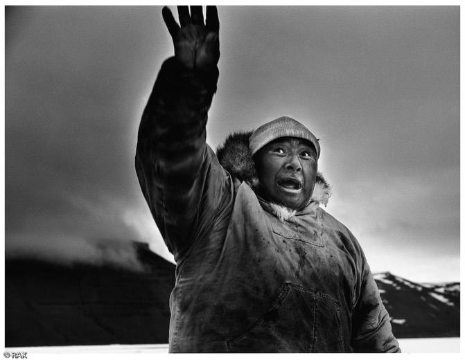
    Human actions have had adverse affects on the Arctic, even its deep sea ocean bed. A new report warns that better care needs to be taken of this vastly unknown area.

    It has been said that humans know less about the deep sea bed then the dark side of the moon. The average depth of 3.8 kilometers makes access for exploration inhospitable and only a handful of the approximately 326 million square kilometers deep ocean bed has been explored.

    “The main problem is that we still know very little of what we call the deep sea, making it difficult to evaluate accurately the real impact of industrial activities, litter accumulation and climate change in the deep sea habitats,” says the team conducting the deep sea project for the Census of Marine Life.

    The report, published in the journal PLOS One says that after dumping waste in the oceans for centuries, humans have introduced invasive species from one hemisphere to another. Climate change has also begun to alter the basic chemistry of marine life with dramatic increases in the concentrations of dissolved CO2 and overall world temperatures.

    The report: Man and the Last Great Wilderness: Human Impact on the Deep Sea

    It also reports that those who want to exploit the oceans must realize that their explorations and actions have consequences. But although human actions can have adverse effects, climate change will be the main factor in the future.

    “We predict that from now and into the future, increases in atmospheric CO2 and facets and consequences of climate change will have the most impact on deep-sea habitats and their fauna,” the report states.

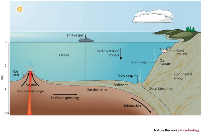
    Finally, the report says that extracting methane hydrates from the seafloor could be more complicated and ecologically sensitive than first thought.

    “Most gas hydrates are buried beneath a thick sediment cap on the sea floor below 250 (meters),” the authors wrote. “In places where gas hydrates intercept the sediment surface … methane seep ecosystems are well developed. Should mass extraction of gas hydrates become a reality, many methane seeps might become subject to disturbance more significant than that of oil and gas extraction.”

    The report: Man and the Last Great Wilderness: Human Impact on the Deep Sea

    Picture: Nature Reviews

  • A New EU-Arctic Newsletter is out

    A New EU-Arctic Newsletter is out

    EU Arctic Forum

    The EU-ARCTIC FORUM, established in 2010, provides the European Parliament a platform on all issues with regard to the Arctic, facilitating exchange and input of information as well as interlinking the fragmented debates on the Arctic within the EU.

    The newsletter informs about activities in particular of the EU-ARCTIC-Forum and gives an overview on the development of the Arctic issues within the European Union.

    The June 2011 Newsletter can be read HERE

  • Call for Proposals to be supported via the INTERACT Trans-National Access program for the summer season 2011

    Call for Proposals to be supported via the INTERACT Trans-National Access program for the summer season 2011

    Arctic Portal news

    International Network for Terrestrial Research and Monitoring in the Arctic INTERACT has a main objective of building capacity for identifying, understanding, predicting and responding to diverse environmental changes throughout the wide environmental and land-use envelopes of the Arctic.

    INTERACT was proposed by the existing SCANNET network of field stations situated in all eight Arctic countries. The cooperation has a long history between the European members, resulting from EU-funding in 2001-2004 within the 5th Framework Programme. This bottom-up network has expanded during the last 6 years with new members from Russia and North America to become a true circumarctic network of terrestrial field stations.

    The INTERACT contract under FP7 has a Trans-National Access program that offers access to 18 research stations in Northernmost Europe and Russia. The call is now open for the summer season 2011.

    For further information, please visit the INTERACT homepage

  • Arctic current warmer than for 2,000 years

    Arctic current warmer than for 2,000 years

    arctic lake

    A North Atlantic current flowing into the Arctic Ocean is warmer than for at least 2,000 years in a sign that global warming is likely to bring ice-free seas around the North Pole in summers, a study showed.

    Scientists said that waters at the northern end of the Gulf Stream, between Greenland and the Norwegian archipelago of Svalbard, averaged 6 degrees Celsius (42.80F) in recent summers, warmer than at natural peaks during Roman or Medieval times.

    “The temperature is unprecedented in the past 2,000 years,” lead author Robert Spielhagen of the Academy of Sciences, Humanities and Literature in Mainz, Germany, told Reuters of the study in Friday’s edition of the journal Science.

    The summer water temperatures, reconstructed from the makeup of tiny organisms buried in sediments in the Fram strait, have risen from an average 5.2 degrees Celsius (41.36F) from 1890-2007 and about 3.4C (38.12F) in the previous 1,900 years. The findings were a new sign that human activities were stoking modern warming since temperatures are above past warm periods linked to swings in the sun’s output that enabled, for instance, the Vikings to farm in Greenland in Medieval times.

    “We found that modern Fram Strait water temperatures are well outside the natural bounds,” Thomas Marchitto, of the University of Colorado at Boulder, one of the authors, said in a statement. The Fram strait is the main carrier of ocean heat to the Arctic

    Source: Reuters / Alister Doyle

  • Future Central Arctic Shipping Route

    Central Arctic Shipping Route

    A shipping route through the central Arctic Ocean depends on significant reduction of ice thickness in that area.

    The so-called multi-year ice in the central Arctic Ocean has been changing drastically (up to 40% decrease) and disappearing completely in the last 50 years.

    If this development continues, ships with icebreaker abilities can navigate the central Arctic Ocean in nearest future.

    The image shows a possible new shipping route in the future. Of course much of the ice would have to melt for this to come to reality.

    The image also shows shy Iceland hopes to be utilized regarding Arctic Shipping, possibly with a hub-port to Europe and America.

  • Northwest Passage

    Northwest Passage shipping route

    The Northwest Passage is first and foremost considered to be continuous passage between islands and the continental mainland of Canada rather than an actual shipping route.

    The Passage represents a potentially attractive and valuable commercial shipping route if it were to become more accessible for navigation and at a longer period of the year. In reality, it is a series of passages trough straits of the Arctic Archipelago.

    It allows shipping from the North Atlantic Ocean, up Davis Strait between Canada and Greenland. The passage then continues trough the Arctic Archipelago, to the Beaufort Sea over to Chukchi Sea and the Bering Strait into the North Pacific. Because of the many islands of the Arctic Archipelago, the potential shipping routes are in fact several each way.

    However some straits are more feasible than others due to the formation of the land under water.

    As with the Arctic itself, the status of the Northwest Passage was given limited attention until the latter part of the 20th century. The reason for that, as with other ice-covered areas of the Arctic, is that no particular interest was shown to utilize the route for transport and the conditions were thought to be dangerous. The tables have certainly turned and the Northwest Passage is now seen as a revolutionary opening for large scale transportation by ships from the North Pacific to the North Atlantic Ocean.

  • Shipping Routes

    Arctic Shipping Routes

    Two sea routes have been defined to cross the Arctic, enabling ships to move between the Atlantic ocean and the Pacific ocean and thus have the possible status as international strait (or waters) giving right to transit passage.

    Both of them overlap significantly the jurisdiction of either Canada or Russia, which can create certain legal difficulties if or when Trans-Arctic shipping becomes a reality.

    If sea ice continues to retreat in the Arctic, a central Arctic shipping route can possibly become a reality.

    This would also reduce the distance that needs to be covered by marine vessels.

    On the menu to the left more information can be found on the Northwest Sea Route and the Northeast Sea Route, as well as the more distant possibility of the Central Arctic shipping route.